(The moghst exciting “roadgeeky” thing about this article is the Regency Bridge. Scroll down 2/3 of the way to see the photos of the only suspension bridge open to vehicular traffic in Texas.)
I visited my family in San Angelo, TX for Thanksgiving. (Nobody is from there, but my grandparents and an uncle’s family happen to live there right now.)
On the way there, I took almost all back roads. The “preferred” route is to take I-20 west to Abilene, US 83 south to Ballinger, then US 67 to San Angelo. I’ve done that route several times, so it has lost its excitement.
An alternate route is to take US 67 all the way from Dallas to San Angelo. I did that in April. It was different, but it wasn’t very exciting.
This time I did most miles on Texas Farm to Market roads, some on Texas State Highways, and a little Interstate driving.
I couldn’t have asked for better weather:

The whole day was mostly sunny and in the 70s.
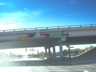
I started out heading south on Buckner Blvd. (a.k.a. Loop 12). I took Buckner all the way through Buckner and Lake June, a notoriously unsafe part of Dallas.
Here’s where Buckner crosses under Military Pkwy. Notice how Dallas used black-trimmed traffic signals? My neighborhood is fighting to get touches like this integrated into a upcoming rework of the Buckner Rd./Garland Rd. intersection.
Buckner and Lake June:
I continued south to where Buckner turns into Murdock Rd. I was surprised to see how rural that area quickly became. It would be a nice area if only it wasn’t so close to a high-crime spot. Where Murdock weaves left and becomes Dowdy Ferry Rd., I accidentally continued straight. I drove past Lincoln Memorial Park Cemetery, which was pretty attractive. However, I could tell that Rylie Rd. was a major dump site. Loads of illegal trash was all over the place. There’s no telling what area residents are encountering.
I got back on to Dowdy Ferry Rd., continued south to I-20, then headed west on I-20. Closer to I-20’s intersection with I-45 is the start of the experimental “no trucks in left lane” project:

I-10 west of downtown Houston is where this experiment first took place. Crashes decreased by 68%, so Texas expanded the program. It’s being tried out on I-20 south of Dallas and I-30 east of Ft. Worth.
I continued on I-20 to I-35E, then headed south on I-35E.
I-35E is just a typical interstate. Much of the construction south of I-20 was completed. However, construction picked up a few miles south of Desoto, squeezing traffic down to one lane in several areas. I was able to zip around most of the backups on the access road.
This is a typical I-35E scene just north of Waxahachie:

Now the fun begins. In Waxahachie, I exited on FM 66. Bye bye interstates! The rest of the trip was on Farm to Market and Texas State Routes. This was a typical scene for the next many miles:

I thought the following construction zone was interesting. Instead of using flaggers to regulate traffic flow on a 1 lane part, the construction zone utilized a set of portable traffic signals:

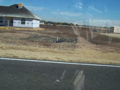
At various points on FM 66, I saw new homes like this:

I had no idea why someone would want to live in the middle of nowhere, surrounded by nothing but flat, boring cropland. Later, someone explained that it’s probably because of proximity to Dallas. I still don’t get it. Huge commutes just for this?
After Maypearl, I encountered another one lane construction zone regulated by a portable signal:

I wasn’t clear what the holdup was:

Here are more of those goofy, “middle of nowhere” houses:
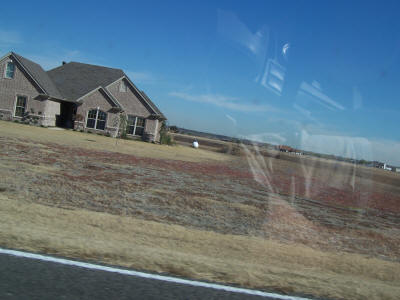
Boooooooring.
On a short jaunt before I-35W, FM 66 has what appears to be the original cement surface:

That was neat. The rest of the road was traditional asphalt.
Finally crossing I-35W
(Stupid camera focused on my radar detector or windshield, not the road.)
I drove through Itasca and got on FM 934. Just west of TX 171 in a community called Osceola, I saw this bizarre scene:

You’re seeing boys and girls playing volleyball. The girls are all in long skirts and have long hair. I never imagined you can find sects this close to DFW. This particular group calls itself the Osceola Christian Fellowship.
FM 934 T-ed into FM 933, I took FM 933 south into Whitney. From Whitney, I took TX 22 west. In Whitney, I got off the road to see this neat wood frame church, King Memorial United Methodist Church:

That reminded me of when I used to live in small towns in east Texas.
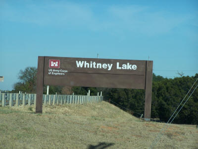
A few miles west of Whitney, I was treated with the Lake Whitney Dam. On the west side of the dam was a road that led to an area where you could observe the dam more closely. You’ll see these signs on each side of that road:

I couldn’t get a good vantage point for pictures, so here are two pictures showing most of the dam:

I’m not sure about this, but the power lines leading to the dam almost suggest some hydroelectric power production is happening.
Panning to the right:

It was nowhere near as large as Hoover Dam in Nevada & Arizona, but impressive nonetheless.
Here’s that sign:

Below the dam are some of these signs:

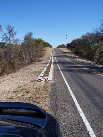
Continuing on TX 22, I saw many construction zones that looked like this:
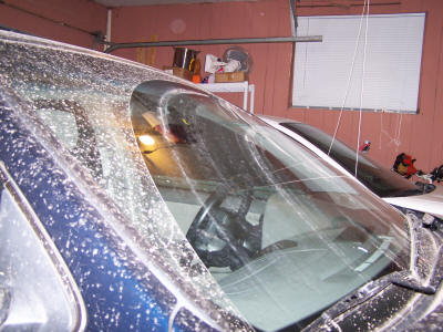
(In this picture, the wife can see that the car really was clean before I left!)
They didn’t make a bit of sense. A long concrete pad with what looked like cardboard boxes spaced evenly. A closer look:

(I should use telephoto more often!)
And a better view of one of the “boxes”:
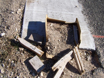
After Meridian (where I stopped for lunch), I figured out what was going on:

Guardrails! The boxes were probably reserving an area that can easily be dug out to set guardrail posts.
I continued on TX 22 to Hamilton. After Hamilton, I headed west on FM 218 until TX 16, then south 7.1 miles to county road 124. Yes, I did some gravel county roads! Yahoo Maps Beta found a few county roads that shaved a couple of miles off my trip. Here is a typical scene:
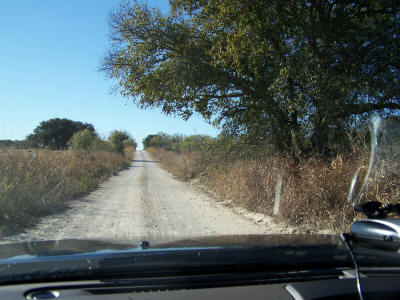
I probably did about 5 miles on the county roads. That stirred up a lot of dust:

You may notice in the above picture that the car is precariously diving to the left. I wasn’t paying close enough attention and allowed the car to wander. When my attention got back on the road, I was starting to slide into shallow ditch. I left off the gas and jerked the wheel to the right, and the whole car started to lose traction as it tilted right. Jerking the wheel back to the left, I managed to correct and regain course. Man, that was a close one. The worst part was that if something happened, I had no cell phone signal, and I wouldn’t have realized that I did this right before the other FM road with which I was connecting back to main roads. Yikes! Lesson 1: pay careful attention to gravel roads. Lesson 2: don’t jerk the wheel! That’s how Ford Explorers roll over, and that’s how normal cars easily lose control.
Here’s the specific route:
- CR 124 west to CR 120.
- CR 120 south to CR 113.
- CR 113 west, merge on to CR 114.
- CR 114 to FM 1029.
- FM 1029 south briefly to CR 118.
- CR 118 west to US 84.
- US 84 north to FM 573 in Mullin
I didn’t pass any cars on those county roads.
In Mullin, I took FM 573 west to FM 574, then FM 574 west to FM 45.
Here’s a typical scene on FM 573:

(I took this picture at 3:02 PM. By this time, the sun was getting lower in the sky, and my camera started doing a better job at focusing on windshield roadkill bugs than on the road.)
Well, that was the original plan.
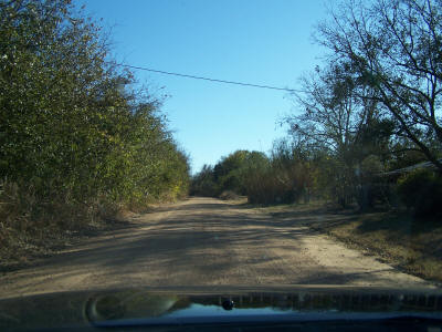
A few miles before FM 45, I stopped at a historical marker. The marker said that an old suspension bridge is on the adjacent county road. So I headed south on CR 433. A typical scene from CR 433 as I head into the Colorado River basin:

At one point I saw some deer, but I wasn’t fast enough to photograph them. But I saw this tall fence, which I figure is that controversial deer fencing:

Another typical scene:
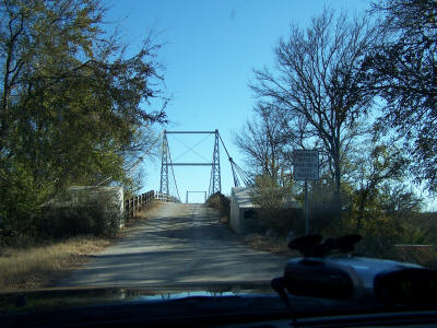
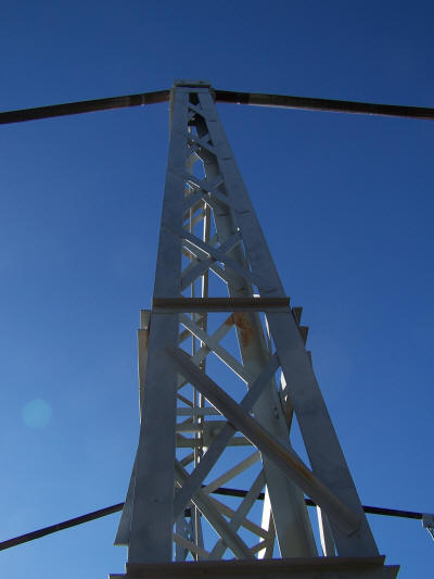
Man, was that ever a treat! This is the Regency Bridge, apparently the only suspension bridge in Texas open to vehicle traffic. It has a wood road surface, and it was mostly hand built in the ’30s.
The approach:

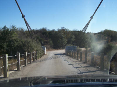
Driving on the roadbed:

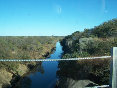
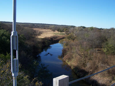
The Colorado River heading downstream from the bridge:
Departing the bridge:
I had to get out and take a closer look myself. After shutting the car off and getting out, I was taken aback at the dead silence. It was about as silent as Death Valley. That kind of quiet is a rare thing in this day.
Here is where the wires mount to concrete blocks on each side:

The Colorado River upstream:
The support wire:

A tower:
I’m sure I was technically trespassing to take this photo, but I wanted to get a good side view of the bridge:

Another view of the bridge surface:

Looking north:

This bridge has the lowest weight limit I have ever seen.
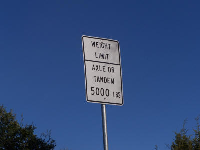
The warning sign:
I am thankful I diverted my route to see this bridge. It was worthwhile.
Here’s a Google Maps link to this bridge’s location. Zoom out to figure out how to get to local roads.
I continued south on CR 137 (the road designation changes at the river) to FM 500, then west to FM 45, then north to FM 765.
I continued on FM 765 almost all the remainder of the way to San Angelo.
On this trip, I learned that these back roads are not well patrolled. I only saw one Maypearl city cop sitting on the side of the road well east of Maypearl, TX. (I’m not clear what he could have done unless Ellis County gave Maypearl cops concurrent jurisdiction.)
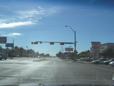
My return trip was not exciting. I took US 67 to Dublin, then US 377 to I-20 in Benbrook, then I-20 to US 67, then US 67 back into Dallas. I picked up a case (24 12 oz. cans) of the “real sugar Dr Peppers” in Dublin for $10. Besides that, the only interesting thing was this traffic signal setup in Brownwood:

I don’t remember seeing such a setup before.
This trip, and especially the county road driving, left the car a little messy: